Port of Alaska – Former Defense Fuel Support Point
- View detailed information from the database on this site.
- Database Name: Port of Alaska - Former Defense Fuel Support Point
- Status: Cleanup Complete - Institutional Controls
- Location: Anchorage
- Latitude: 61.232903
- Longitude: -149.879873
- DEC Contaminated Sites contact: Evonne Reese, Institutional Controls Unit, 907-465-5229
- Click on photos or maps for larger versions.
- Contacts updated: 2/16/2023
- Summary updated: 2/16/2023
Site Narrative
Description
Map courtesy of U.S. Geological Survey.
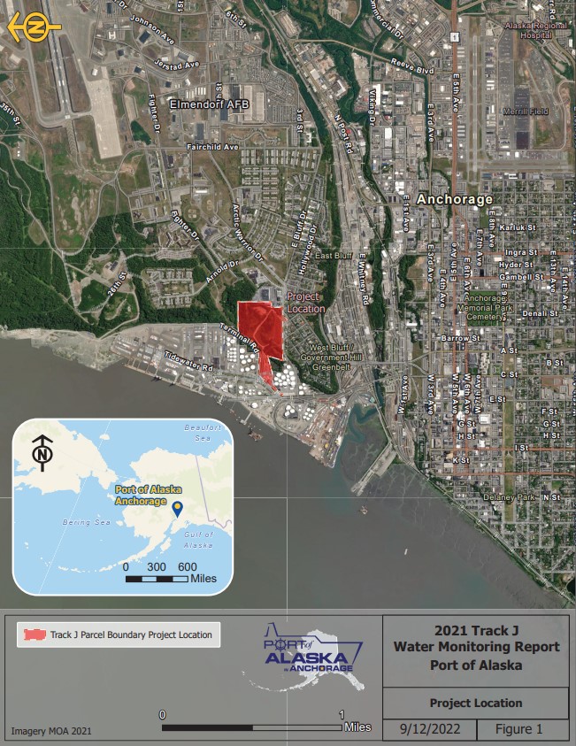
The Port of Anchorage – Former Defense Fuel Support Point (also known as the Anchorage Petroleum Terminal) is at 1217 Anchorage Port Road, and it covers about 69 acres on what is now Port of Anchorage land. The site is bordered by Elmendorf Air Force Base (now called Joint Base Elmendorf-Richardson) on the north and east, the Government Hill community to the south, and various petroleum tank farms operated by private companies to the west, southwest and northwest.
From 1942 until 1996, when the support point was decommissioned, the Defense Fuel Support Point received, stored and issued fuel via pipelines, ships, rail and truck to and from Elmendorf, Kulis Air National Guard and Fort Richardson, Fort Greely and Fort Wainwright.
Public Health and Environmental Concerns
Previous investigations have identified roughly 27 releases of various petroleum fuels and transformer fluid between 1960 and 1989. Fuel-related contaminants, semi-volatiles and metals have been identified in the soil, sediment, groundwater or surface water.
Response Actions: 1987 through 2018
- 1987: Woodward Clyde Consultants conducted a site investigation and a soil gas survey.
- 1992: Shannon &Wilson prepared a summary site assessment of the Port of Anchorage area for the Port Users Group.
- 1993: Dames & Moore collected and analyzed groundwater samples, which were incorporated in a site-wide monitoring report for the Port Users Group.
- 1999: Shannon & Wilson conducted a facility-wide human health and ecological risk assessment.
- 2000: A Proposed Plan was developed and finalized identifying removal of petroleum contaminated soils as the preferred alternative. Long-term monitoring of the groundwater and surface water will continue until cleanup levels are met.
- 2001: All tanks and piping were removed from the site. Roughly 20,000 cubic yards of contaminated soil were removed, treated and brought back to the site.
- 2003: DEC and the Defense Energy Support Center-Alaska signed a Record of Decision in 2003 to memorialize the actions taken in 2001 to address the contaminated soils and identified institutional controls for soil and groundwater.
- 2006: DEC granted the Defense Energy Support Center-Alaska a determination of no further remedial action planned, however, long-term monitoring will continue and institutional controls will remain in place.
- 2011: The Army turned over ownership of the property to the Port of Anchorage.
- 2012: Eleven monitoring wells decommissioned in 2012. Sheen noted during surface water sampling which is an exceedance of 18 AAC 70 water quality standards but total aromatic hydrocarbons and total aqueous hydrocarbons (TAH and TAqH) cleanup levels are not exceeded.
- 2013: DEC requests ethylene dibromide and 1,2-Dichloroethane (gasoline additives) be added to the suite of contaminants being monitored at the Port of Alaska and change to low-flow sampling techniques instead of bailers.
- 2014: Ethylene dibromide and 1,2-Dichloroethane were sampled and not detected in groundwater sampled at the Port of Alaska.
- 2015: Benzene and diesel range organics (DRO) continue to decline in monitoring wells at the site and two wells recommended for decommissioning. Sheen observed during surface water sampling.
- 2016: Five-Year Review recommended along with a statistical analysis of existing groundwater data. Sheen continues to be observed during surface water sampling. However, TAH and TAqH cleanup levels have been met from 2012 through 2016.
- 2017: As of February 2017, the institutional controls (ICs) enacted by the Record of Decision (ROD) and extended by the Quit Claim Deed appear to remain in force at the site.
- 2018: First Five-Year Review conducted to assess protectiveness of the cleanup remedy. Key recommendation was to cease groundwater monitoring due to the shallow groundwater not being suitable as a drinking water source due to being brackish and unfit for human consumption. Shallow groundwater is not within a recharge area for a private or public drinking water well. ADEC approves recommendations and all groundwater monitoring ceases at the site. Surface water monitoring will continue.
- Annual monitoring results showed that all contaminants were below the applicable cleanup levels. No petroleum sheen was noted during surface water sampling.
- 2019: Annual monitoring results, for sites SS12 & SS14, showed that total aromatic hydrocarbons and total aqueous hydrocarbons (TAH and TAqH) exceeded the applicable cleanup levels of 0.010 and 0.015 milligrams per liter (mg/L), respectively. Petroleum sheen was noted during surface water sampling which is an exceedance of 18 AAC 70 water quality standards.
- 2020: Annual monitoring results, for sites SS12 & SS14, showed that total aromatic hydrocarbons and total aqueous hydrocarbons (TAH and TAqH) exceeded the applicable cleanup levels of 0.010 and 0.015 milligrams per liter (mg/L), respectively. Petroleum sheen was noted during surface water sampling which is an exceedance of 18 AAC 70 water quality standards.
- 2021: Annual monitoring results showed that total aromatic hydrocarbons (TAH) exceeded the applicable cleanup level of 0.010 milligrams per liter (mg/L), the at site SS12. Petroleum sheen was not noted during surface water sampling.