Alaska’s Water Quality Standards, Assessment, and Restoration Program Annual Highlights 2018
December 2018
Table of Contents
- Cottonwood Creek stormwater
- What is stormwater?
- Haines stormwater mapping
- Southeast river survey
- Agency collaboration
- Ketchikan beaches
- Clean vessels outreach
- Anchor River restoration
- Water Quality Standards
- Alaska fish consumption
- Ketchikan creeks monitoring
- Cruise ship monitoring data
- Botanical Garden runoff
- Duck Creek Wetland
- What we do for Alaska
- Contacts
Using Natural Design to Improve Cottonwood Creek’s Water Quality (Wasilla)
By Laura Eldred
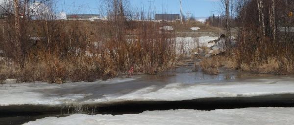
Polluted runoff flows out of a culvert, through streamside vegetation, across the ice and into Cottonwood Creek’s open water on Fern Street outside of Wasilla. This project will stop the polluted runoff and treat it before it reaches the creek.
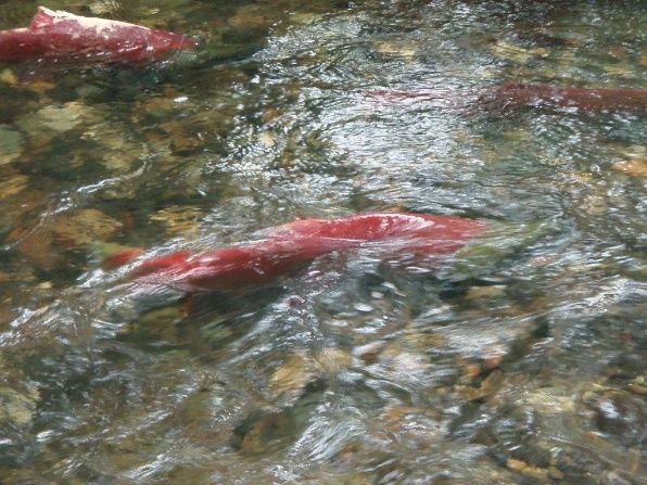
Cottonwood Creek is a salmon stream that flows through neighborhoods and also the Wasilla urban commercial district. Before emptying into Knik Arm, the creek picks up pollutants along its route mostly from stormwater runoff. In fact, Cottonwood Creek is considered a water quality impaired stream with bacteria pollution but is of concern for other urban pollutants such as copper. DEC has funded several projects designed to reduce the polluted runoff getting into Cottonwood Creek and to improve its water quality (see previous newsletter editions).
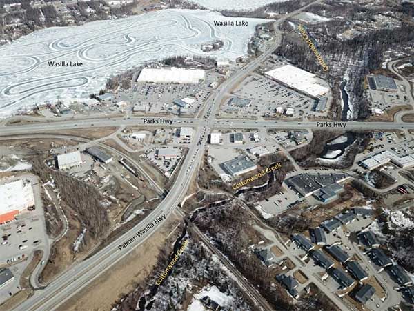
Aerial view of Cottonwood Creek as it flows through the Wasilla commercial district. DEC will consider a potential future project to restore a section of creek bank in this area that is currently draining polluted stormwater to the creek.
Using DEC Alaska Clean Water Actions (ACWA) grant funding, the DEC Nonpoint Source section is currently working with landscape architects at Sustainable Design Group to fix an area where polluted stormwater is entering Cottonwood Creek off of Fern Street in the Wasilla area. Working with partners at the City of Wasilla and the Alaska Department of Transportation and Public Facilities, the project will capture stormwater runoff as it comes out of a culvert, slow it down and soak it into specially designed treatment works to remove sediment and pollutants. The new treatment basin is being designed right now and will be installed after break up in spring 2019.
The project will use green infrastructure techniques to clean up the stormwater. Green infrastructure incorporates both the natural environment and engineered systems to provide clean water, conserve ecosystem values and functions, and provide a wide array of benefits to people and wildlife. The cleaner water entering Cottonwood Creek will provide a healthier habitat for the salmon and other aquatic life – plus it will look nice!
What is stormwater?
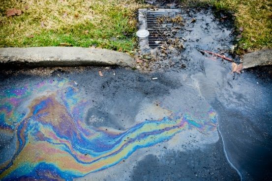
Stormwater is runoff that occurs when rain or snow melt moves across the land picking up contaminants such as sediment, bacteria or metals and deposits them into local streams, lakes, wetlands and coastal waters.
Polluted stormwater is one of the leading sources of water quality impairments nationwide and in Alaska.
Stormwater Mapping in Haines (Southeast)
By Gretchen Augat
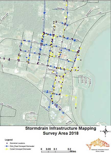
Stormwater mapping is being completed in Haines, AK.
Haines is small community with approximately 2,500 residents. The majority of residents live in or around the Haines townsite, which in turn has the most development. Much of the stormwater drains directly into Lynn Canal and Sawmill Creek, however there is no comprehensive map showing all of the stormwater infrastructure and flow direction.
Through a DEC Alaska Clean Water Actions (ACWA) grant, a stormwater planning and mapping project is underway to complete a comprehensive map. The stormwater plan will include an overview of Haines hydrology, a stormwater infrastructure inventory, and identification of sediment-source areas and associated green infrastructure best management practices (BMPs) that would better protect the water quality of the Haines townsite.
Using this stormwater plan, the Borough will be better informed to make decisions affecting stormwater management and to know where to respond if there is a spill into the system to keep it from reaching local waterways. The reduction of sediment and other pollutants to Sawmill Creek, Lynn Canal, and other area waters will be a valuable and long-lasting environmental benefit.
Southeast River Survey (Southeast)
By Amber Bethe
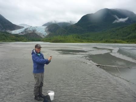
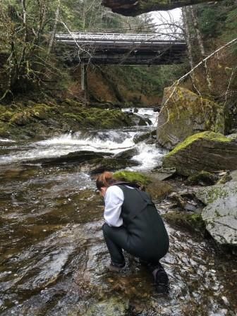
DEC Water Monitoring staff Amber Bethe prepares to collect samples as part of the Southeast Rivers Survey summer 2018.
The Alaska Monitoring and Assessment Program conducts surveys of rivers, streams, wetlands, lakes and coastal areas throughout the State. These surveys help us answer questions like is water quality changing and what are natural water conditions like?
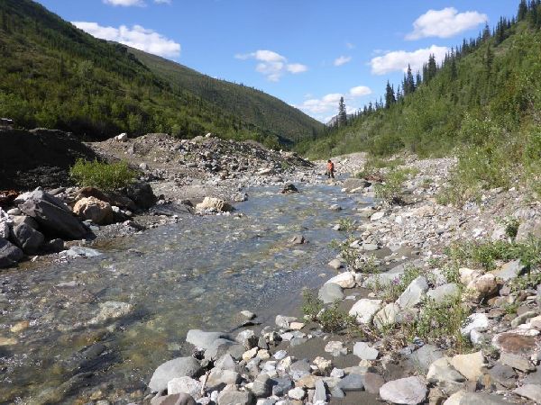
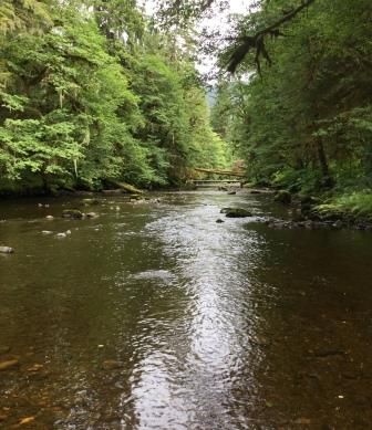
In summer 2018 we surveyed 36 river sites to complete the Southeast River survey, the second of 4 surveys to be completed in Southeast Alaska. Sites were selected from rivers across Southeast Alaska south of the 60th parallel, with an emphasis on sites in the Stikine, Taku and Unuk River watersheds.
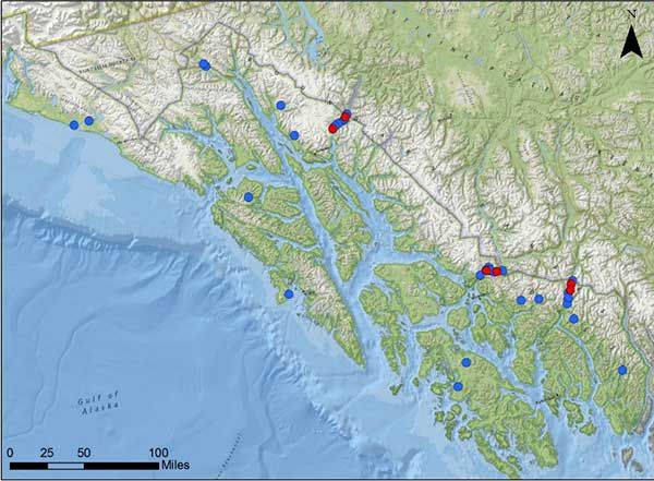
Sites surveyed from July to August 2018 for the Southeast River Survey
Accessing randomly selected sites in Alaska can be a challenge. Sites are frequently in remote and difficult to access locations. For this project we accessed sites by airplane, helicopter, boat, bike, car and on foot. Once we arrived at a site and verified that it met our survey requirements, we conducted a survey using methods from the EPA National Rivers and Streams Assessment.
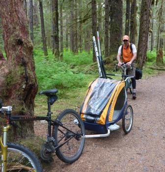
Remote sampling sites had to be accessed in a variety of ways including bikes.
We collected samples and information from 11 evenly spaced transects along a length of river. At the first transect we collected water samples to be analyzed for metals, nutrients, total suspended solids, chlorophyll, algal toxins and bacteria (enterococci). Fine sediment (if available) was collected throughout the reach, and analyzed for stable isotopes, total organic carbon, metals and grain size. Physical habitat measurements were recorded at each transect including assessments of riparian habitat, instream fish habitat, vegetation cover, substrate and human impacts. Benthic macroinvertebrates and periphyton were collected from each transect for identification.
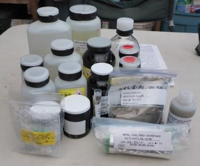
Collected samples are prepared to go to different laboratories for analyses as part of the Southeast River Survey.
Samples from the survey are currently being analyzed at various laboratories and complete results are expected in 2019. This information will be used to help determine baseline conditions for rivers and streams in the region, and help us understand if water conditions are changing over time. Results will be posted on the Water Quality Montioring web page where you can find information on previously completed surveys in other areas of Alaska. DEC thanks all of the partners involved with the Southeast River Survey. We couldn’t have accomplished it without you!
Agency Collaboration (Dalton Highway)
By Chandra McGee
Mined site on Gold Creek showing some of the tailing piles. BLM collected turbidity readings from this area.
In July, Chandra McGee (DEC Nonpoint Source) and Nick Dallman (DEC Placer Mining Coordinator) took a trip up the Dalton Highway to meet with Bureau of Land Management (BLM) partners to conduct joint water quality monitoring and placer mine site visits. In addition to the DEC staff, the group included five BLM staff.
A couple years ago, Ms. McGee worked closely with BLM fisheries biologists on the development of a quality assurance and project plan to conduct water quality monitoring associated with placer mining. BLM staff has been collecting the data ever since. This visit was an opportunity for DEC staff to see the sites on the ground, evaluate the site conditions, and collect some quality control samples for the monitoring project.
The main goal of the trip was to visit sites on Gold Creek, where BLM has deployed several long term data collection instruments focused on turbidity pollution. In addition to Gold Creek, the group also visited sites on Prospect Creek and Nolan Creek.
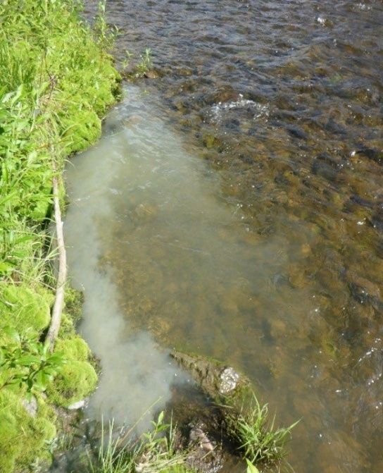
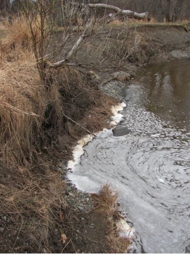
The cloudy murky water entering this clear water stream is an example of turbidity. Unnatural levels of turbidity can be harmful to aquatic life.
The trip into Gold Creek was a day long adventure by ATV. The group started just north of Coldfoot and headed east up Gold Creek. They stopped at 11 sites where Ms. McGee collected water samples for turbidity. In addition, the BLM hydrologist downloaded data and checked on the data collection instruments. The group traveled all the way up the creek to the headwaters.
Along the way, a variety of site conditions were observed, including currently active mines with areas of concern for erosion as well as historic reclamation sites. The on-the-ground site evaluations and discussion with BLM staff provided Ms. McGee and Mr. Dallman a wealth of information on Gold Creek, which has a complicated past history of disturbance and challenging current conditions with respect to meeting state water quality criteria.
Ketchikan Beach Program (Southeast)
By Gretchen Augat
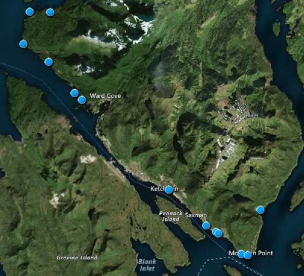
Ketchikan BEACH monitoring locations 2017-2018
The Beaches Environmental Assessment and Coastal Health (BEACH) Act was passed by Congress in 2002 in response to increased occurrences of water-borne illnesses nationwide. DEC’s Nonpoint Source section implements the Alaska BEACH program.
In 2017-2018 recreation seasons, we monitored for fecal coliform bacteria along the Ketchikan coastline. Marine water samples were collected to evaluate potential health risks by fecal coliform and enterococci bacteria, and to notify the public when levels exceeded allowed limits.
To address additional community and tribal concerns on southern Ketchikan beaches, which are heavily used for recreation and marine foods harvesting, the 2018 monitoring program included new beaches at Rotary Beach, Mountain Point and Herring Cove.
Results showed bacteria exceeded safe levels at 9 beaches. Source tracking tests show bacteria is associated with humans and gulls at all the beaches, and for dogs at 9 beaches.
There are numerous potential bacteria sources present along the Ketchikan coast including: private and public sewer treatment system outfalls, public treatment system emergency bypasses, sewer line breaks, individual septic tanks, wildlife, pet feces, boats in harbor and launch areas, and private watercraft, ferries, and cruise ships. Pathogens in recreational waters can be naturally occurring, or they can be introduced through contamination events with the feces of humans and other warm-blooded animals. Two groups of bacteria, fecal coliform and enterococci, are measured as indicators of fecal waste contamination in marine waters. Commonly documented health issues from swimming in contaminated recreational waters include gastrointestinal illness, respiratory illnesses, skin rashes, and ear, eye, and wound infections. Protecting human health is part of DEC’s core mission.
Bacteria monitoring at Knudson Cove beach as part of DEC's BEACH monitoring program 2017-2018.
The Environmental Protection Agency administers grant funds to states, tribes and territories under the Act to establish monitoring and public notification programs. BEACH programs have been set up in 15 Alaskan communities including Ketchikan. The Ketchikan BEACH program was developed in collaboration with the Ketchikan Indian Association, City of Ketchikan, and Ketchikan Gateway Borough. The Ketchikan Indian Association performed the monitoring activities at all the Ketchikan coastal beaches. Beach sampling will continue during the 2019 recreation season. Find more information about the Water Quality BEACH program.
Clean Vessels Grant Outreach (Statewide)
By Chandra McGee
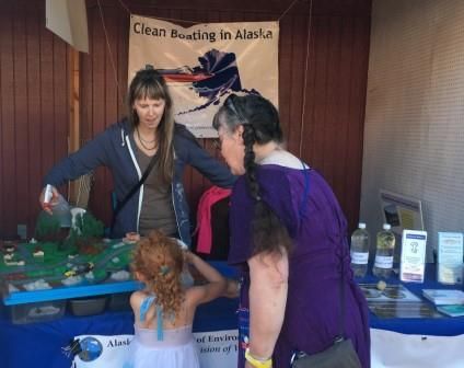
Alaska Clean Vessels outreach booth at the Southeast Alaska State Fair in July 2018. Pictured is DEC NPS program staff Chandra McGee teaching a young boater about reducing pollution to protect water quality.
Alaska has over 90,000 registered recreational motor boaters, many of whom need to manage the sewage waste from their boats. Unfortunately, many Alaskan recreational boaters are not aware of the need to use sewage pump out stations or how to properly treat marine sewage discharges. In addition, many harbors lack pump-out systems, or the current infrastructure is not user friendly or convenient.
In response to this need, DEC’s Nonpoint Source section is working with partners to implement an education and outreach campaign across coastal Alaska, using grant funds from the Coastal Clean Vessel Act program from the Alaska Department of Fish and Game. The goal of the outreach program is to improve water quality in inland waters and harbors.
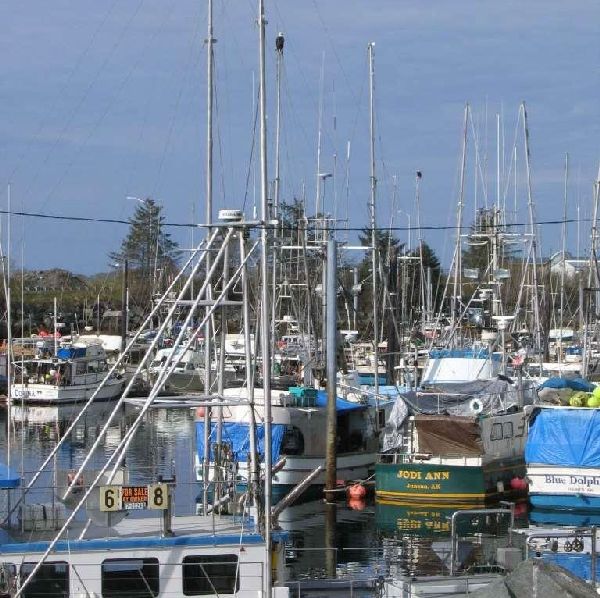
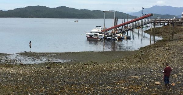
Boat harbor in Sitka, AK
A number of successful outreach activities occurred in 2018. All events included information on how boaters can help protect water quality with clean boating tips, and on ways to reduce nonpoint source run-off pollution. Sewage pump-out “kits” that included quick-connects and various items (gloves, absorbent pads, hand sanitizer) were provided to interested boat owners. DEC also had lots of fun give-aways, including pens, writing pads, floating key chains, and brochures.
New this year was having an outreach booth at the Southeast Alaska State Fair in Haines. In collaboration with the Marine Exchange, DEC NPS staff hosted a booth for all three days of the fair and shared a lot of information on clean harbors, using marine sewage pumpout stations, and other clean boating tips. The weather was beautiful and staff engaged with lots of residents and visitors over the weekend. Folks were proud to learn that Haines is an Alaska Certified Clean Harbor!
Find more information on the Alaska Clean Harbors website. If we all work together, we can help keep Alaska’s waterways clean!
A Second Chance for the Anchor River (Kenai Peninsula)
By Jeanne Swartz
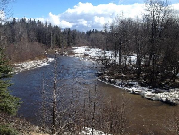
The Anchor River is a popular recreational destination but is experiencing erosion.
The Anchor River, located in the lower part of the eastern Kenai Peninsula, has been a historically fish-productive river. Beloved by Alaska fishermen for its famous runs of steelhead trout, and home to several species of Pacific salmon, it has been a destination for many visitors and local residents alike. However, due to its popularity and local road development to support access, the Anchor River has suffered degraded streambank habitat in the past several decades.
Collaborating with several partners, DEC’s Nonpoint Source section is working to help improve Anchor River’s streambank and improve water quality.
The Homer Soil and Water Conservation District and DEC flagged two areas of the Anchor River for possible streambank restoration in 2006. In 2018, the time was right to act on those plans. The Department of Natural Resources (DNR) Division of Parks and Outdoor Recreation (Parks) received funding from the Exxon Valdez Oil Spill Trustee Council to restore portions of the Anchor River Recreation Area downstream from the locations identified by the Homer Soil and Water Conservation District and DEC. The DNR Parks work is planned to begin in 2019, so the opportunity to share resources made the project timing very attractive.
Anchor River eroded streambank. This is one of the restoration sites being planned for summer 2019.
Using funding from a DEC Alaska Clean Water Actions grant, the Homer Soil and Water Conservation District is working with other local non-governmental organizations to develop a plan to rehabilitate the Anchor River streambank at the sites earlier identified.
Restoration strategies are currently being developed, with the on-the-ground activities to take place in the summer of 2019. The Alaska Department of Fish & Game plans to incorporate the Anchor River site restoration work as part of a community training event. The Homer Soil and Water Conservation District has been recording its work through video footage and have created a Facebook page with up-to-date information on the restoration work. A final project video will also be publically available at the project’s conclusion.
What are State Water Quality Standards?
Water Quality Standards, found at Title 18, Chapter 70 of the Alaska Administrative Code (AAC) (18 AAC 70), are the basis for DEC programs to protect the state waters. Standards establish the maximum allowable levels of chemical pollutants and are used as the regulatory targets for permitting, compliance, enforcement, and monitoring and assessing the quality of the state's waters.
The Standards define water quality goals by designating uses for rivers, streams, lakes and other surface waters, setting criteria to protect those uses, and establishing antidegradation provisions to preserve water quality. More information about water quality standards.
Fish Consumption in Alaska (Statewide)
By Brock Tabor
Alaskan diets have always been suspected of varying based on where you live but we now ‘know’ that this is the case. On November 30, DEC’s Water Quality Standards section posted two reports on the DEC Homepage pertaining to fish consumption and DEC’s effort to update human health criteria in state Water Quality Standards. While these two reports do not represent DEC’s policy on fish consumption, they do serve as key resources and will inform efforts to complete rulemaking (including adoption of a revised fish consumption rate for use in various regulatory programs for protection of human health.
The first report, Preliminary Regional Analysis of Fish Consumption Rate Estimates for Rural Alaska Populations, despite its long title, is the first comprehensive effort to establish fish consumption rates (FCRs) using methodology and data developed by the Alaska Department of Fish and Game Division of Subsistence (ADF&G). This effort was underwritten by a reimbursable service agreement with DEC. The report documents fish consumption rates in Alaska’s rural regions on a statewide basis as well as documenting species consumed on a regional basis. The data was collected by ADF&G between 2008 and 2014 and considered to be the most complete dietary dataset currently available.
Alaska is updating its fish consumption information. Photo courtesy of ADF&G
The second report, DEC Human Health Criteria Technical Workgroup Final Report, documents five years of deliberations by the Human Health Criteria Technical Workgroup on aspects of the human health criteria formula used by states to set water quality criteria. The report provides a summary of each of the different issues (e.g., drinking water intake, other sources of pollutant exposure), challenges, and recommendations to DEC for consideration during the rulemaking process. DEC will utilize this document as it engages with stakeholders over the next year and ultimately develops draft rulemaking language.
If you are curious as to just how much you may eat over the course of a year in terms of grams per day, go to the DEC Fish Consumption Calculator and plug in your own information – you may be surprised!
Ketchikan Creeks Water Quality Monitoring (Southeast)
By Gretchen Augat
Ketchikan Indian Community assisted DEC in collecting water samples from Ketchikan Creek
Using funding from the DEC Alaska Clean Water Actions program, the second year of water quality monitoring was performed by the Ketchikan Indian Community in Ketchikan’s urban creeks. The study evaluated the impacts from urban development and stormwater runoff within the fresh water drainages of Ketchikan, Hoadley, and Carlanna Creeks.
The baseline study revealed elevated ammonia and fecal coliform levels in the creeks, suggesting a wastewater source. Elevated metal levels of cadmium, copper, zinc, and lead were also found in the creek water and sediments. The results show a decreasing trend in stream health.
Preliminary 2018 results indicate that there continues to be elevated fecal bacteria levels within all 3 creeks, with the most elevated levels in Ketchikan Creek. Source tracking tests show bacteria from humans within each creek, again with the most elevated levels in Ketchikan Creek.
A final report will be posted on DEC’s website in spring 2019.
Carnival Cruise Ships – Water Quality Monitoring Stations that Also Transport Visitors to Alaska
By Jeanne Swartz
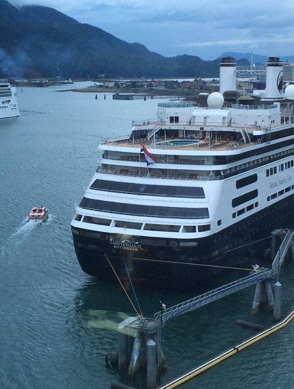
Cruise ship docked in Juneau, AK
With names like Emerald Princess and Westerdam, DEC’s most unique water quality monitoring locations moved majestically through the Inside Passage and paused at Glacier Bay, in transits between Vancouver, BC and various seaports in Alaska during the 2018 cruise season. Excited passengers enjoyed all-you-can-eat buffets and photographed whales while down below the waterline, Hach ULTRATURBs and other sensors recorded water temperature, pH, turbidity, conductivity, and salinity every fifteen minutes and transmitted the data to computers at Axiom Data Science, an informatics and software development firm located in Anchorage, Alaska. Axiom Data Science posted the data on the Alaska Ocean Observing System website. Additionally the data was provided to the Anchorage DEC office.
This unique arrangement came about through an agreement between the Carnival Corporation and EPA. Named the Alaska Supplemental Environmental Project, Carnival Corporation’s cruise ships operating in Alaska collected water quality data from April – October, 2018. Carnival made the monitoring data available to DEC. DEC has a water quality database named AWQMS designed to store and organize water quality data until it is needed by anyone in the Division of Water. Ed White, manager of the DEC cruise ship program, facilitated the arrangement with WQSAR staff. With some behind-the-console wizardry provided by GoldSytems, Inc., and generous assistance from staff at Carnival Corporation and Axiom Data Science, over a million records of baseline ambient water quality information now resides in AWQMS.
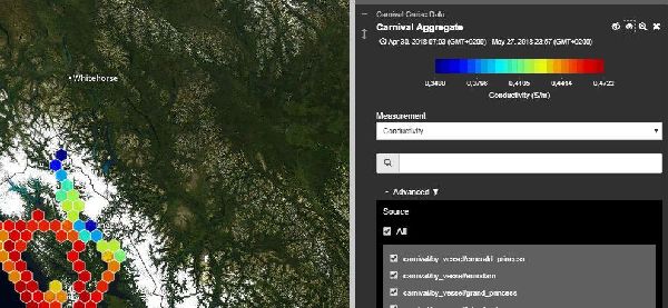
Screenshot of summer 2018 real-time conductivity data from a Carnival cruise ship as provided to the Alaska Ocean Observing System website.
The data is potentially a valuable resource of information about marine water conditions in state waters outside of the traditional monitoring locations in harbors and bays. It may be useful for future permitting or waterbody health decisions. Monitoring data is ordinarily expensive to collect and limited in scope. Having this much data available for a modest investment is a true benefit for not only the cruise ships and DEC, but also for all Alaskan citizens.
Green Infrastructure at the Botanical Garden (Fairbanks)
By Chandra McGee
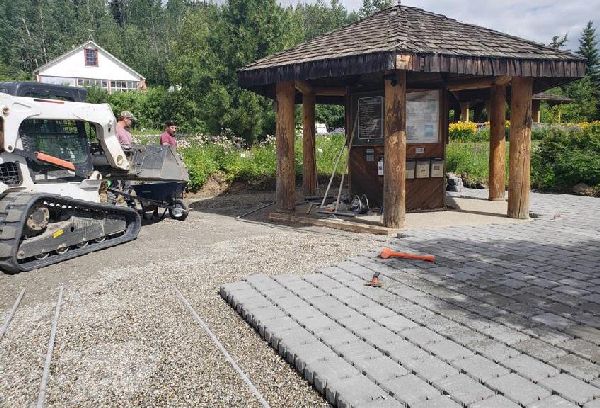
Permeable paver installation at the Fairbanks botanical garden. Permeable pavers allow rain and snowmelt water to soak into the ground and not runoff to local creeks.
In 2018, DEC awarded an Alaska Clean Water Actions (ACWA) grant to the Georgeson Botanical Garden in Fairbanks to install several green infrastructure (GI) projects.
The GI projects will serve dual purposes. First, they will be designed to store and divert stormwater runoff that might otherwise go untreated. Second, the garden receives many visitors in the summer, and the projects will raise awareness of green infrastructure techniques. The grantee hosted a series of public workshops and will install permanent educational signage in early 2019.
Early in summer 2018, a permeable paver patio was constructed at the entrance to the garden. Not only will the pavers reduce dust and create a visually appealing entrance area, but stormwater runoff and rain will soak in instead of running off into nearby culverts. A second permeable paver pathway was added later in the summer to direct visitors to the garden’s Rotary Pavillion. During installation, the public was invited to come and learn about the process.
Additional workshops on GI included Stormwater Trees, Grass Mesh installation, and Water Catchment Systems. If you’re in Fairbanks next summer, stop by the garden and check out the projects!
Is the Water Quality Improving in Duck Creek? (Juneau)
By Gretchen Augat
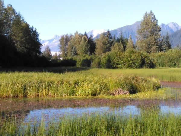
Nancy Street wetland is part of Duck Creek. The wetland helps to clean up polluted water and also provides wildlife habitat.
Duck Creek is a small, clear-water stream located in the Mendenhall Valley in Juneau, Alaska. Using DEC Alaska Clean Water Actions (ACWA) grant funding, a water quality study was conducted to assess the effectiveness of the previously installed Nancy Street Wetland restoration project.
Several gravel extraction ponds within the Duck Creek watershed were formed from the 1950s and 60s dredging to support Mendenhall Valley development. These extraction pits filled primarily with groundwater that was high in iron and low in dissolved oxygen. This affected the water quality in the downstream parts of Duck Creek. Duck Creek has been listed as water quality impaired for low dissolved oxygen, fecal coliform bacteria, trash and excess sediment and iron since 1994.
The Church of the Nazarene pond was converted into a wetland in 1998 and the Nancy Street pond followed in 2006. These created wetlands were constructed to improve fish and wildlife habitat and water quality on the east fork of the Duck Creek. The wetland plants increase dissolved oxygen and decrease iron and sediment in downstream reaches by trapping the iron flocculent and fine sediments in the wetland.
The monitoring data shows improvements in the water’s quality especially for dissolved oxygen, water temperature, turbidity, and suspended sediments. It’s very encouraging to note that the wetland provides suitable habitat for fish and wildlife, improves water quality, and has become a valued community area. So is Duck Creek’s water quality improving? We are happy to say yes it is!
Who Are We and What Do We Do?
Alaska has more water in the form of lakes, streams, rivers, coastline, and wetlands than any other state in the union. In fact, nearly half of the total surface waters of the United States are located within Alaska. The Water Quality Standards, Assessment & Restoration (WQSAR) program at DEC provides information and technical assistance for water quality standards, water quality monitoring, water data collection, and water quality information management in support of human health and the environment.
The WQSAR program is broken into four sections that work together accomplishing program goals:
- Water Quality Monitoring and Reporting
- Nonpoint Source Water Pollution Prevention & Restoration
- Water Quality Standards
- Quality Assurance/Quality Control
In Alaska, surface water sources supply fresh water for three-fourths of the water needed for industry, agriculture, mining, fish processing and public water use. Surface water is also the source for about half of the domestic water supply. Alaska surface waters include tens of thousands of salmon streams, which are an important resource for Alaskans and the world. WQSAR, with technical staff located around the state, is responsible for protecting human health and the environment in this vast and water-rich state.
As you can tell from this newsletter, we are a busy program accomplishing a variety of work. We invite you to get to know us better and support the work we do every day in keeping Alaska’s waterways healthy.
Contacting WQSAR Staff
- Terri Lomax
- Statewide Program Manager
- 907-269-7635
Quality Control/Quality Assurance
- John Clark
- Quality Assurance Officer
- 907-269-4913
Water Quality Monitoring & Reporting
- Chandra McGee
- Section Manager
- 907-451-2140
- Amber Bethe
- 907-269-7955
- Morgan Brown
- 907-451-2141
Nonpoint Source Water Pollution Prevention & Restoration
- Laura Eldred
- Section Manager
- 907-376-1855
- Gretchen Augat
- 907-465-5023
Water Quality Standards
- Brock Tabor
- Section Manager
- 907-465-5185
These projects have been funded wholly or in part by the United States Environmental Protection Agency under assistance agreement BG-00J84603 to the Alaska Department of Environmental Conservation. The contents of this document do not necessarily reflect the views and policies of the Environmental Protection Agency, nor does mention of trade names or commercial products constitute endorsement or recommendation for use.
 Indicates an external site.