GC-2 Oil Transit Line Release
- Location
- A transit line between Gathering Center 2 (GC-2) and GC-1, Western Operating Unit, Prudhoe Bay, Alaska
- Time/Date
- The spill was first discovered by BPXA operators at 5:45 AM, March 2, 2006. The spill was reported to ADEC by the State Troopers at 6:15 AM, March 2, 2006.
- Spill Id
- 06399906101
- Product/ Quantity
- 212,252 gallons crude oil, which includes the following: 199,191 gallons of liquid crude oil recovered and evaporated from the spill site, 12,909 gallons entrained in the tundra trimmings/soil removed from the site, 152 gallons entrained in the gravel removed from the site.
- Cause
- The joint incident investigation report dated April 14, 2006 confirmed that the leak occurred as a result of internal corrosion. The source was a quarter inch hole at the 6 o'clock position in an above ground 34-inch diameter crude oil transit pipeline. The hole was discovered in the pipe within a buried culvert (caribou crossing).
ADEC Situation Reports
- 03/28/2008 (PDF)
- 05/03/2006 (PDF 40K)
- 04/10/2006 (PDF 42K)
- 04/03/2006 (PDF 46K)
- 03/28/2006 (PDF 46K)
- 03/20/2006 (PDF 46K)
- 03/17/2006 (PDF 45K)
- 03/15/2006 (PDF 45K)
- 03/13/2006 (PDF 45K)
- 03/10/2006 (PDF 42K)
- 03/09/2006 (PDF 42K)
- 03/08/2006 (PDF 43K)
- 03/07/2006 (PDF 43K)
- 03/06/2006 (PDF 52K)
- 03/05/2006 (PDF 52K)
- 03/05/2006 (PDF 53K)
- 03/04/2006 (PDF 52K)
- 03/04/2006 (PDF 53K)
- 03/03/2006 (PDF 53K)
- 03/03/2006 (PDF 53K)
- 03/03/2006 (PDF 43K)
- 03/02/2006 (PDF 408K)
- 03/02/2006 (PDF 32K)
Press Releases
- 03/10/2006 -- Unified Command Arrives at Spill Volume Estimate
- 03/07/2006 -- ¼ inch hole found in line, crude source under control
- 03/06/2006 -- UC develops plan to estimate spill volume and excavation begins
- 03/05/2006 -- Source of Crude Oil Leak Located; Clean-up Continues
- 03/04/2006 -- 570 Barrels of Fluid Recovered to Date; 24-Hour Clean-up Continues
- 03/03/2006 -- Response Continues on Prudhoe Bay Spill
Additional Information
Fact Sheets
- Prudhoe Bay (courtesy of BP, PDF 72K)
- Separation Facilities (courtesy of BP, PDF 474K)
- NS Crude Oil - NOAA Fact Sheet (PDF 406K)
Maps and Aerial Photos
- Oil Depth (map created 3/14/2006, PDF 1.2 MB)
- Oil Spill Location Grid (revised 3/12/2006, PDF 269K)
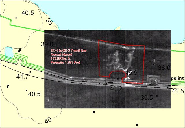
- Forward Looking Infrared Radar (FLIRR) Overlay map of spill area (March 3, 2006)
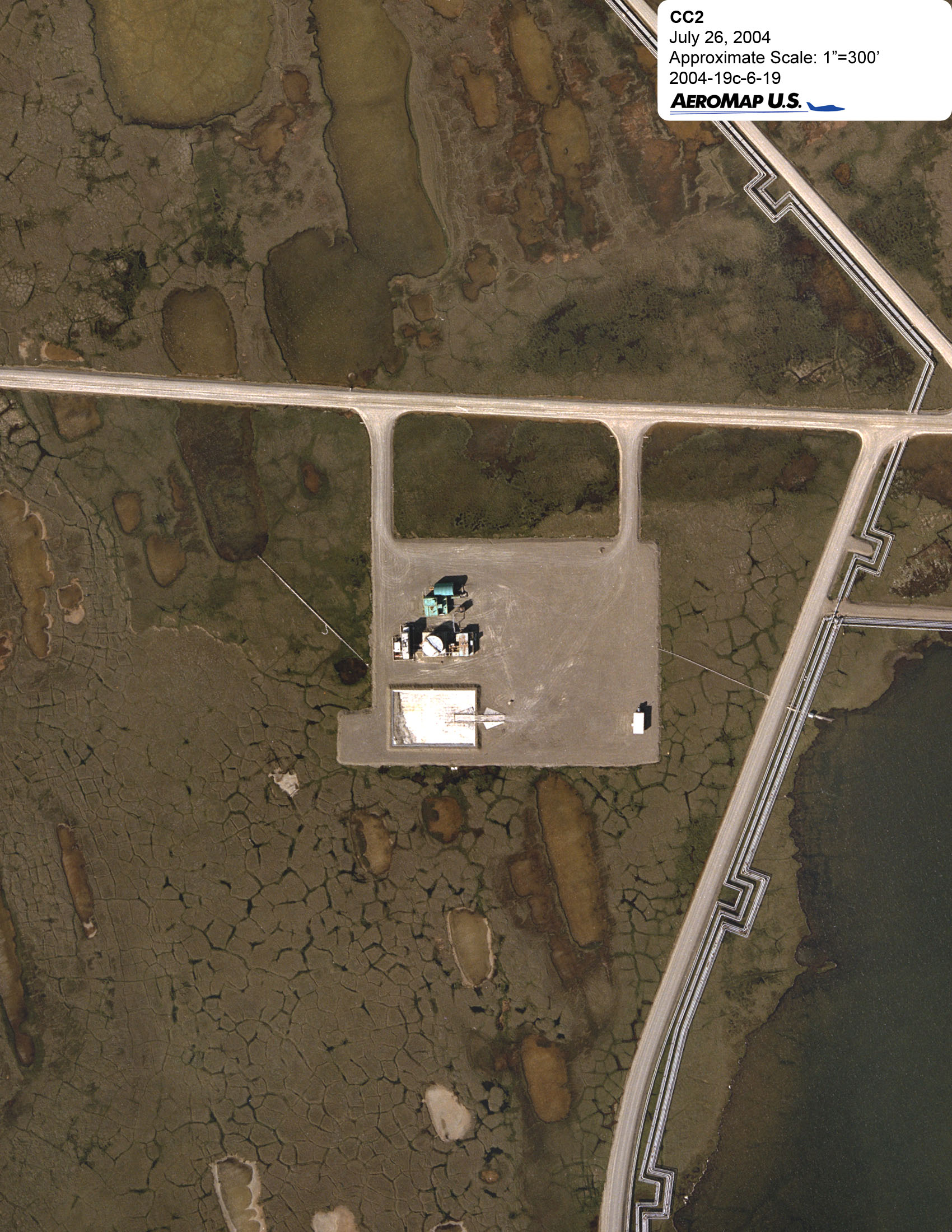
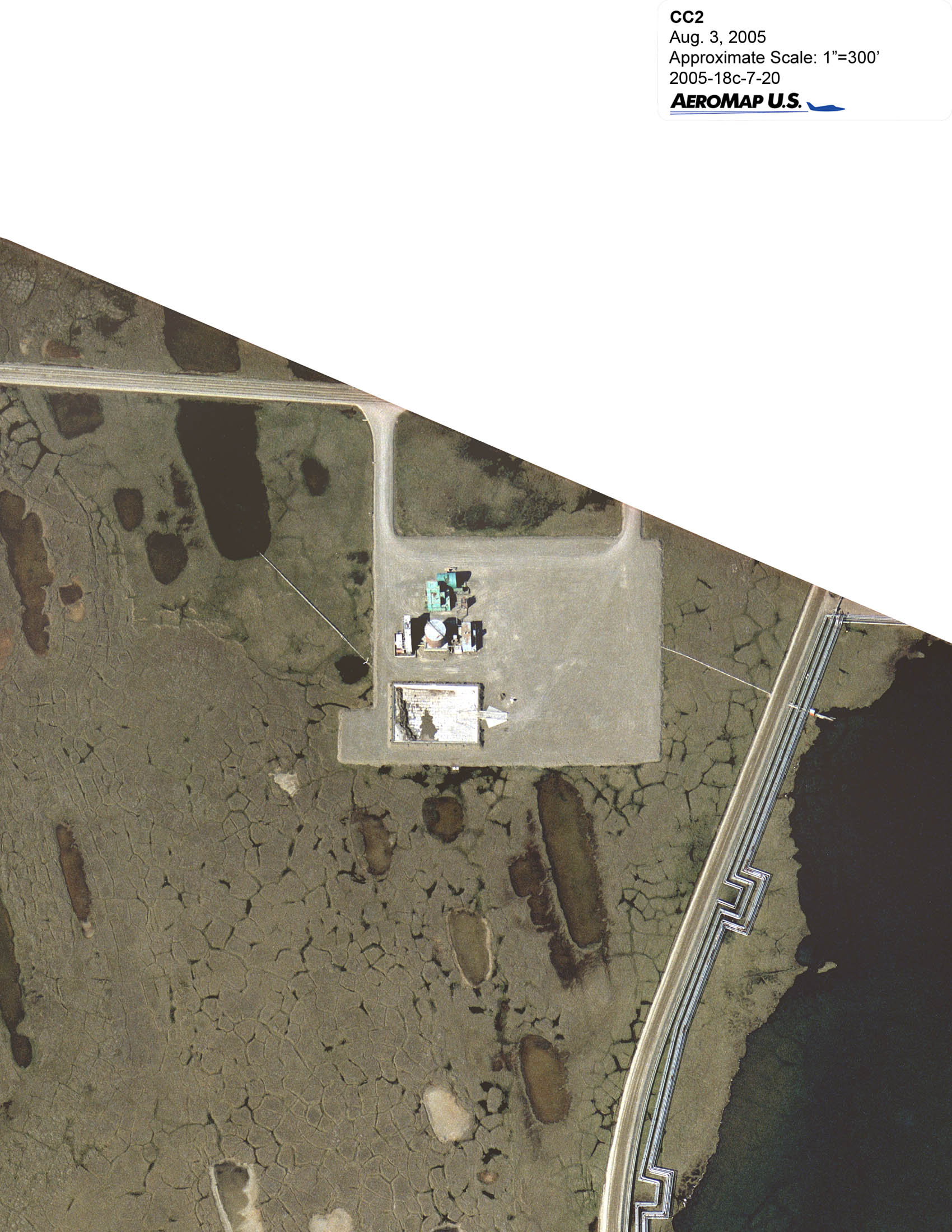
- Aerial view of CC-2, storage location for contaminated snow and ice removed from the spill site.
- Prudhoe Bay Production Facilities (courtesy of BP, PDF 72K)
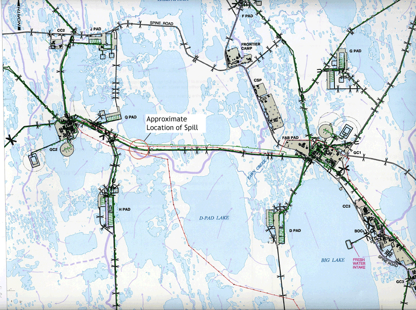
- Map showing extent of spill (PDF 594K)
- Map showing facility location
Photos
Images may be downloaded for free and used in publications provided credit is given to the source.
March 03, 2006


March 05, 2006


March 06, 2006


March 16, 2006


March 19, 2006


April 05, 2006


April 15, 2006


April 18, 2006


April 20, 2006


July 06, 2006


 Indicates an external site.