Using the Contaminated Sites Database
The Contaminated Sites Program provides information about thousands of contaminated sites across
the state through a public database available on its website. This resource allows people to find out if a property has been contaminated, view its cleanup status, access the latest site assessments and reports, and contact DEC staff overseeing the site.
Search Features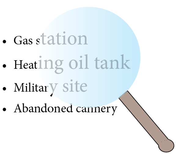
Searches can be made by:
- Property Type (gas station, airport, etc.)
- Location (address, city, borough, coordinates)
- Site Name
- Hazard or File ID Number
- Institutional Controls
Users can download search results or the entire database as an Excel spreadsheet if necessary.
Site Report Information
Each entry in the database has its own site report page with information about the site's past and current status. The information includes:
- The contact information for the DEC staff member overseeing the contaminated site.
- A chronology of the site's history of uses, types of contamination found, assessments, monitoring and cleanup actions.
- Documents, written decisions, and reports from assessment and cleanup activities.
- If cleanup has been completed, a list of Institutional Controls and requirements is provided.
Search Tips
When using the database it is best to use broad terms before refining the search. For example, users looking for a specific site may not know exactly how it is named in the database. It can be helpful to first generate a list of sites by using broad search fields such as site type, borough, or city.
If you already know the location of a contaminated site, you may have better luck accessing the site report by finding the site on the database's ArcGIS map.
Contaminated Sites Map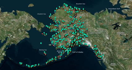
The Contaminated Sites Program uses ArcGIS software to generate a map of the sites contained in its database. The icons on the map show each site's location and current status. Users can select an icon on the map to view the name of the site, its address, the DEC staff contact, and visit the site report page for more detailed information.
Site Status
The status of each contaminated site falls into one of four categories:
Active sites have confirmed contamination above action levels and require additional characterization, monitoring, or cleanup before a closure decision can be made.
The Cleanup Complete status generally includes sites where remediation efforts are complete and any remaining contamination is below levels that pose a threat to human health or the environment.
The Cleanup Complete-Institutional Controls status generally includes sites where no further remediation is planned but the potential for future exposure to residual contamination warrants Institutional Controls that inform people of contamination and limit activities that could result in exposure to, or the spread of, the contamination.
The Informational status is used to identify site records that do not represent a distinct contaminated site. This status also identifies sites that have received EPA or DEC Brownfields services and cannot be classified as "active" as well as properties that have an Environmental Covenant (EC) or Notice of Activity and Use Limitations (NAUL) and are not considered source contributors.
For More Information
For information specific to a site please contact the DEC staff person listed in the site report for each entry in the database.
For database support contact DEC.Spar.CS.Database@alaska.gov
 Indicates an external site.